47-079-01200
Well drilled in 1996
Producing formation(s): Devonian shale, upper and lower
Geographic location: latitude 38.525804, longitude -81.759453
Visited first in 2008
Three wells were examined that were off Harmon's Creek Road near the King Cemetery. Their access road is gated at several points.
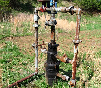
This well was set in a broad open area with its tank in a large secondary containment dike with the cut slope as its fourth wall. We couldn't see a rainwater drain for the dike.
The well entrance was an earth road off a graveled road and had deep ruts. This occurs where the entrance road crossed drainage from the hillside. Drainage should be improved in this area and the entrance graveled.
The site was well grassed, amongst the better vegetated sites we examined but there was a peculiar area clear of grass, much churned by deer hooves. This is a feature we've seen at other sites and we wonder if the soil is salty in this area.
Maintenance problems include a need for paint on all the metal of the site and a fluid leak at one or more points on the Christmas tree. A temporary repair of the pipe to the tank perhaps needs to be made permanent.
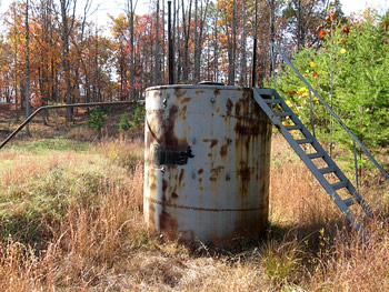
All of the metal at this well was sorely in need of paint.
This tank is set within a substantial dike that unfortunately doesn't have a rainwater drain.
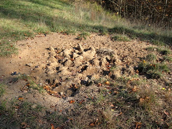
There was a churned up area on the pad, bare of vegetation. It seems to be popular with deer and that may indicate the soil has salt in it.
The pipe to the tank had a fixed leak but we wonder how permanent such a fix is.
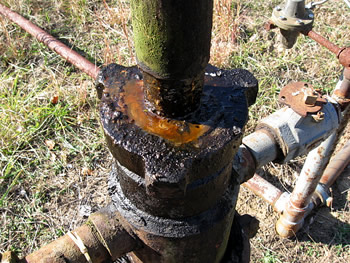
There was a visible oil-like leak at the Christmas tree.
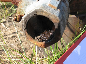
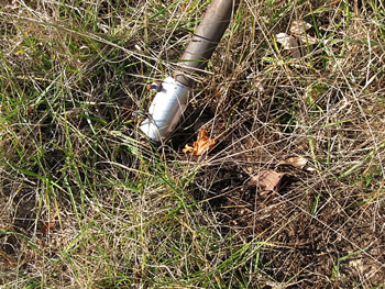
This pipe end also seems to be oozing gunk.
Visited again in 2011
We visited the site again in 2011.
None of the metalwork at this site is painted. Note the oil leak at the wellhead.
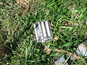
The API number for this well had fallen from the wellhead and was lying on the ground.
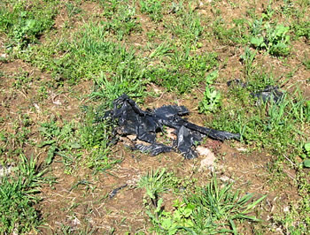
The surface owner had tilled garden areas on each side of the access road on the pad. On the southern side there was a large area covered with pieces of pit liner. Some of the large pieces of pit liner were still firmly embedded.
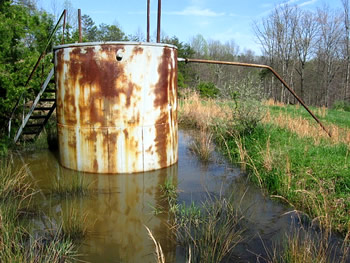
The 100 barrel condensate storage tank sat within a water-filled secondary containment. There is no rainwater drain.
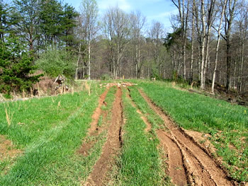
The access road from the gravel road is heavily rutted.
Gas Well Site Visits
Examining Well Sites
How We Examined Well Sites
Environmental Assessment
Table with Links to Wells Visited
47-039-05714 Environmental Assessment
47-079-01492 Environmental Assessment
47-039-02026 Environmental Assessment

Gas Well Study is the examination of natural gas wells in West Virginia.
Underground Injection Control Class 2 Wells
These wells are used either for the disposal of oil and gas liquid waste or for the enhanced recovery of oil or natural gas.
Gas Well Study Site Visits
Annual reports, environmental assessments, and individual well information.
YouTube Videos
Select videos from the Gas Well Study YouTube channel.
What Happened at Fernow
An investigation into what caused the vegetation death in the land application area after landspraying hydraulic fracture flowback waste.
The Spill at Buckeye Creek
An investigation into a spill from a Marcellus well site into Buckeye Creek in Doddridge county.
The Details
Plunger Lift Technology on Gas Wells
Fluids Brought to the Surface during Production
Plugging a Well
How To Read a Lab Report
Information the Completion Report Provides
Casing and Cementing