47-079-01299
Well drilled in 2005
Producing formation(s): Lower Huron and Marcellus Shales
Geographic location: latitude 38.514346, longitude -81.756313
Visited first in 2008
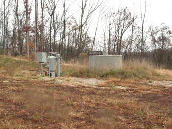
Another well off the long main well access road.
This well in its layout resembled 47-079-01288 and has the same problems. The access road from the main access road is in need of maintenance. The vegetation on the pad is poor and large areas of mineral soil are exposed.
The tank doesn't have the required secondary containment dike.
An exposed 6 inch pipeline on the main access road just before this well and at another spot earlier is an issue. We don't believe that this is safe.
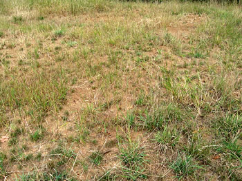
The well pad is very poorly vegetated.

Tank without required secondary containment.
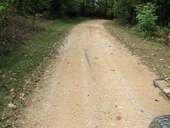
On the main access road at several spots before this gas well the 6 inch gas pipeline is exposed.
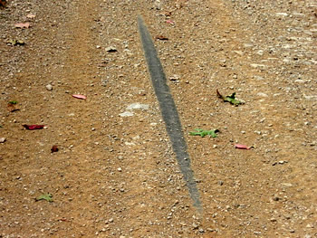
A closer view of the exposed pipeline.
Current rules (35CSR4.16.7.c.2) require pipeline be under at least 18 inch cover, 6 inch if solid rock doesn't permit deeper burial, but existing pipelines were grandfathered in 1983 and perhaps this one dates before then. Even so, it looks dangerous and probably is dangerous.
Visited again in 2010
The access road was more deeply rutted, the nearly bare pad had large areas of standing water, and there signs of severe corrosion for the storage tank.
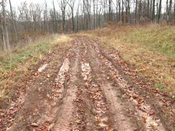
This was the deeply rutted access road to the well site. It is a spur off of what we call the long road.
The pad was poorly vegetated.
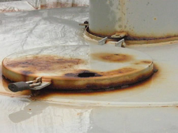
The cover of this storage tank has started to rust through. These storage tanks contain produced water and/or petroleum condensate. Produced water can have the same or more salinity as sea water.

Some parts of the pad showed large numbers of deer tracks. Deer are attracted to these sites at certain times of the year because of the high-chloride contamination. Essentially a well site can be the same as a salt block to a deer.
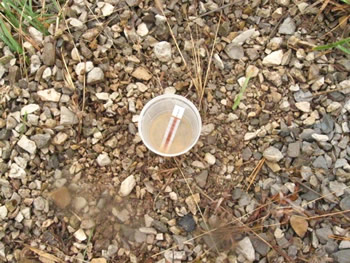
We tested standing water in one spot on the pad and found chloride at 57 ppm, well above background levels. This can be the result of a spill or from buried pit waste.
Gas Well Site Visits
Examining Well Sites
How We Examined Well Sites
Environmental Assessment
Table with Links to Wells Visited
47-039-05714 Environmental Assessment
47-079-01492 Environmental Assessment
47-039-02026 Environmental Assessment

Gas Well Study is the examination of natural gas wells in West Virginia.
Underground Injection Control Class 2 Wells
These wells are used either for the disposal of oil and gas liquid waste or for the enhanced recovery of oil or natural gas.
Gas Well Study Site Visits
Annual reports, environmental assessments, and individual well information.
YouTube Videos
Select videos from the Gas Well Study YouTube channel.
What Happened at Fernow
An investigation into what caused the vegetation death in the land application area after landspraying hydraulic fracture flowback waste.
The Spill at Buckeye Creek
An investigation into a spill from a Marcellus well site into Buckeye Creek in Doddridge county.
The Details
Plunger Lift Technology on Gas Wells
Fluids Brought to the Surface during Production
Plugging a Well
How To Read a Lab Report
Information the Completion Report Provides
Casing and Cementing